Posted on 1 Comment

A student of weather

A student of weather.

Being a pilot means being a student of weather – all the time.

Weather is so fickle in Alberta that you quickly learn how much flying depends on it.

I did my ground school for my PPL a few years ago at Centennial Flight School in Edmonton City Centre airport.  After years of putting it off, I’m finally getting myself in gear to study for my ground school exam.  It’s harder once you’re done ground school and have had a long break from the theory in the lectures. And one of the most challenging topics is weather.  Things like instruments, aerodynamics, aircraft engines, navigation and air law, are more practicable, and used more often on a day to day basis. Many students struggle with weather theory the most.

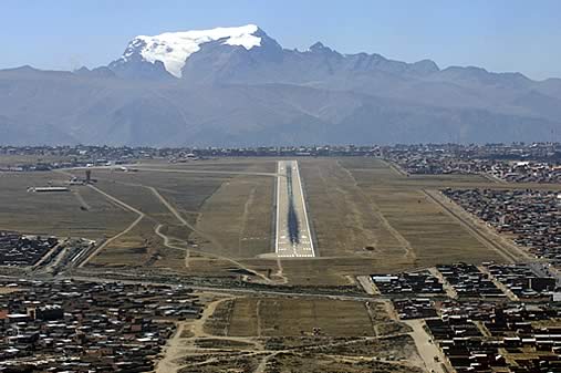
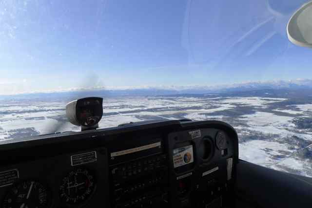
Because I backcountry ski and climb, I feel like I already have a very close relationship with weather, specifically mountain weather. But in no other discipline will you have a more direct relationship with weather that you do when you fly.  It determines whether you can actually go up or not, and your safety while up in the air.  There is no ‘waiting out’ the weather once you make that decision to go up.

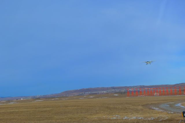
Weather determines whether or not we can fly VFR (with visual reference to the ground).   Fog will ground many of us.  Stay far away from thunderstorms, avoid icing and turbulence.  Mountain waves can be deadly. We need to know how wind shear affects aircraft performance.  Each airplane has a design limit for maximum cross wind – we need to be aware of these limits.

Air Command Weather Manual - by National Defense Canada
Air Command Weather Manual – by National Defense Canada

What are some of the best study aids for weather?

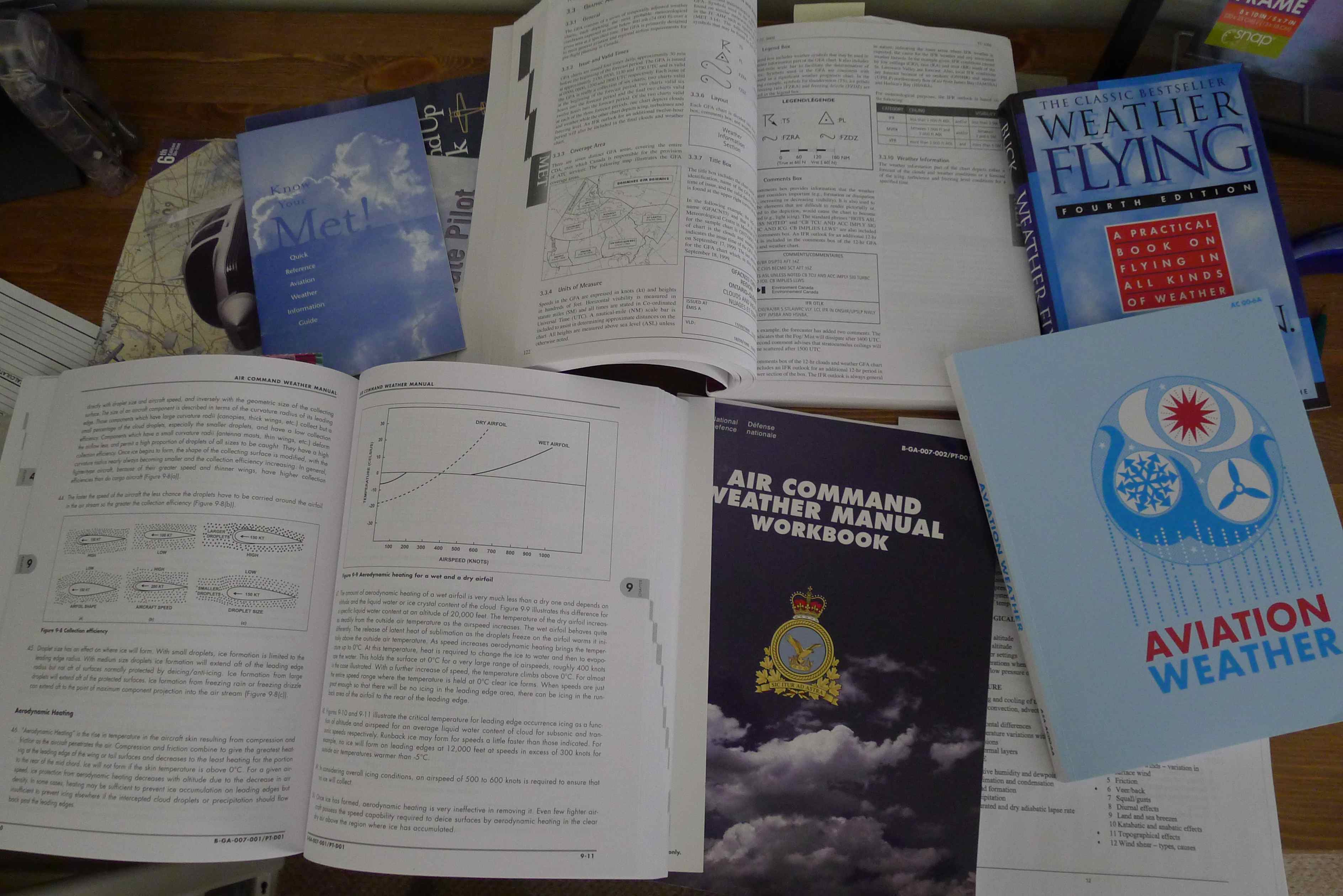
I want to share one of the most useful resources for studying weather I’ve recently discovered: the Air Command Manual which is published by National Defense Canada.  My instructor suggested I purchase it and I am really happy I did.  I find it very comprehensive and easy to follow: important sections are broken down into a series of lectures that can be easily referenced and reviewed.  In addition, an accompanying workbook can also be purchased in which you can test your knowledge in each specific area.  I find it a really great way to review and re-learn the specific weather topics. I have been using it every day since I got it, in preparation for the weather portion of my PPL written exam.


Aeronautical Information Manual (AIM), published by Transport Canada.

Transport Canada’s Aeronatical Information Manual (AIM) is also a very good source of weather information. It presents all of the weather products for aviation, in detail.  It tells us when the reports are published and for what areas, how long they are valid for and what all the various symbols and abbreviations are on the charts.  It is an invaluable study tool. This book is updated regularly and in fact, says on the cover when it is valid. For example, my old AIM book which is pictured was valid from October 22, 2009 to April 8, 2010. This book comes with your ground school kit when you sign up for ground school.

And of course,  the flying “bible”for Canadian pilots, “From the Ground Up” has a very good and detailed weather section, giving us the theory and application.  This also comes standard with your ground school kit.

These books can be referenced again and again, even once you are done your exams and have your license.  Certain areas, particularly when it comes to weather theory are easy to forget and these books exist so they can be easily referenced.  These books should be used regularly in your aviation career.

But of course, the best teacher is actually practical experience. Having all these resources is great but getting out and flying in all sorts of weather conditions, those we can manage of course, is indispensable.

Being a pilot means being a lifetime student of weather.

Review your weather reports!

Many different flight instruction books are available on Amazon

Posted on

Landing and departing at high altitude

El Alto International Airport, La Paz Bolivia. Image Courtesy of BolivaTravelSite.com

I read a post recently asking what is the highest altitude airport you have landed in. This reminded me when I flew into La Paz, Bolivia, landing at El Alto International Airport while on a backpacking trip in South America.  It was aboard a Lan Peru Airlines Airbus A319.   Though I wasn’t doing my pilot’s license back then, I was already very interested in flying, and did my research about this airport, knowing it was 4061 meters, or 13,325 feet above sea level.  If I wasn’t a climber that would have broken an altitude record for me just landing at an airport that high!

Cessna Citation XLS in Tibet, the world's highest commercial airport. Image courtesy of flightglobal.com
Cessna Citation XLS in Tibet, the world’s highest commercial airport. Image courtesy of flightglobal.com

The airport is one of the highest commercial airports in the world.  The runway 10R/28L at El Alto is 4 km (2.5 miles) long.  The only higher airport (that I could find) was Quam Banga Airport in Tibet, which is situated at an incredible 4334 meters – 14,219 feet above sea level! The runway there is an amazing 5.5 km (3.4 miles) long!

In order to land at El Alto, an aircraft must be equipped with special tires in order to be able to handle to high take off and landing speeds.  Only certain airlines provide service to this airport as the aircraft must be modified.

How else does high altitude affect airplanes? Well recall that the higher up we go, the lower the pressure.   Hence higher up the air becomes “thinner” and is less dense.  Denser air results in better aircraft performance.  In fact the four worst possible take-off and climb performance are when the following factors are combined:

1)  Air Temperature is high (above 15 degrees C)

2) Airport elevation is high

3) Atmospheric pressure is low (below 29.92 inches of Mercury)

4) Relative humidity is high.

So why the long runways at these airports? El Alto has a runway that is 4 km long. This is because due to the low pressure that exists at this extreme elevation there is reduced air resistance.  It is harder for the aircraft to slow down, and takes more time. The descent into this airport was noticeably short – the massive mountains looming on each side of the plane, and then before we knew it, the plane was close to the ground, which what felt like a disconcertingly high airspeed. It took a very long time to stop!

Since the highest altitudes on earth are mountainous, it is no surprise that these high altitude airports are surrounded by some pretty massive peaks. In Bolivia, among many other high mountains, Mount Illimani is in the area and looms over La Paz at 6438 meters (21,122 feet).  These mountains create obstacles that need to be cleared. Though they are far away, we learn obstacle clearance on take-off and landing for this reason.

Posted on

The ‘six-pack’ flight instruments: gyroscopes

Continuing on our review of the ‘six pack’ of flight instruments from the instruments that are powered by the pitot-static system, below we review those that are gyroscopes.

A gyroscope is a rotor or spinning wheel rotating and high speed,  and exhibits two fundamental characteristics upon which all practical applications are based.  These are:

  1. Gyroscopic intertia –  or rigidity in space. This is the tendency of the rotating body to maintain it’s plane of rotation if undisturbed.
  2. Precession: This is the tendency of the rotating body, when a force is applied to it at a point perpendicular to the plane of rotation to react as if the force had been applied 90 degrees in the direction of rotation

The three gryroscopic instruments are:

  1. The heading indicator. The main instrument we use to detect heading of the aircraft.  Only operates when the engine is running.  It runs off a vacuum system so we have to adjust it to the magnetic compass every time we fly. Frictional forces in the gyro bearings cause it to precess, resulting in a creep or drift in reading approximately 3 degrees every 15 minutes.
  2. Turn and bank coordinator, sometimes called the needle and ball.  The needle shows the direction and approximate rate of turn. The ball shows the amount of bank in the turn and whether there is any slipping or skidding. The ball is controlled by gravity and centrifugal force.  In a coordinated turn, the ball will be in the center as the centrifugal force offsets the pull of gravity. The instrument reacts to yaw but can be used for roll control since the aircraft yaws when banked.  It can show a rate one turn which gives us 3 degrees per second or a two-minute turn.
  3. The attitude indicator. Modern attitude indicators have virtually no limits of pitch and roll and will be accurate indicate pitch up to 85 degrees, and will not ‘tumble’ in 360 degree rolls.

The instruments are typically powered by the vacuum system and an electrical system for redundancy in case one of the power sources fails.  Often the heading indicator and attitude indicator operate on the vacuum system while the turn and bank coordinator is electrically operated.

Posted on 1 Comment

The “six pack” flight instruments: pitot-static

Flight instruments on a Cessna 172

Let’s do a review of the six main flight instruments: 

Detail is provided, of course, there is so much more we can add here!  The most important and basic flight instruments have remained the same for a long period of time, and are called the ‘six pack’.  Three of them are connected to the static port system which measures outside barometric pressure and the pitot tube which measures ram pressure.   The other three are gyroscopic.

The Pitot Tube on a Cessna 172

The pitot tube, located on the leading edge of the wing, and the atmospheric pressure in the tube is increased by the dynamic pressure due to the forward motion of the aircraft while in flight.  The static pressure port is not affected by turbulence or ram air pressures.

The three instruments connected to the pitot-static system are:

(1) Airspeed Indicator (ASI) – pitot and static source; it measures the difference between the pressure in the pitot tube and the pressure in the static system. When the aircraft is on the ground the two pressures become equal, in motion the pressure difference causes the aneroid capsule inside the indicator to expand, moving the needle on the instrument.

The ASI shows indicated airspeed.  Indicated airspeed can be erroneous because of air density, which depends on pressure and temperature, and position error, which is caused by eddies that are formed when air passes over the wings and struts. This is the uncorrected reading from the dial and calibrated airspeed is the indicated airspeed corrected for position error (and installation error). Equivalent airspeed is the calibrated airspeed corrected for compressibility – this applies mainly to high speed airplanes.  Next we have true airspeed which is calibrated airspeed corrected for pressure and temperature. Roughly, to correct calibrated airspeed we add 2% to the indicated airspeed for every 1000 feet of pressure altitude.  We can gain more accurate readings using our flight computer – the E6B.

(2) Vertical Speed Indicator, static source. Operates on the principle that there is a change of barometric pressure with a change in altitude.  Atmospheric pressure is led into the capsule but slowed by a calibrated leak from entry into the case holding the capsule,  and this pressure differential causes the capsule to expand or compress.  There is a 6-9 second lag before it will indicate the correct rate of climb or descent.

(3) Altimeter, static source. Since pressure varies from place to place and the altimeter set to indicate height above sea level at the departure point may give a false reading after the aircraft has flown some distance.  To correct for this, the altimeter is equipped with a barometric scale (inches of mercury) which allows to set the current altimeter setting. We get this each time we depart our airport and can get it enroute.  If we fly to an airport that has a lower pressure than the one we departed from and we don’t change our altimeter setting, we will read higher than the actual height of the airplane. Temperature differences will also cause erroneous readings since the pressure altimeter is calibrated to indicate true altitude in standard atmospheric conditions.  When the temperature of the air beneath the airplane is colder than standard, the aircraft is lower than indicated, and vice versa for warmer than standard temperatures (higher than altimeter reading) .

Here are what we can expect from a compromised static-port system.

Instrument Pitot Tube Blocked Partially Blocked Static Port Fully Blocked Static Port
Altimeter Not connected Under-read in climb, over-read in descent Freezes
Vertical Speed Indicator Not connected Under-read in climb, less than true rate of descent Freezes at 0
Airspeed Indicator Acts like altimeter. Over-reads in climbs and under-reads in descents Under-read in climb, over-read in descent Under reads in climbs and over reads in descents.

Read about the other 3  instruments that are gyroscopes: the heading indicator, attitude indicator and turn and bank coordinator.

Do you have any other specialty instruments in your aircraft?

Posted on

Decision making and turbulence

Pulling the pin!

I went out to the Cremona area this morning, intending to practice precautionary and forced approaches. Last time I went to practice them, it was not only busy in the practice area but there was also a small forest fire in the quadrant in which I was established, and couldn’t descend low enough to practice the procedures. As soon as I got close to 5000 feet the smoke smell became quite intense.  Since the ground in the area is around 4300′, I wanted to descend to 4800′ (I can only descend to 500′ feet above ground when flying by myself) to practice. But as soon as I hit 5000 it was already too much. That coupled with heavy traffic and a Bell helicopter that was returning flying at an altitude similar to the one I was using kept me busy. Eventually, I ran out of time and had to head back, and though I did one of each precautionary and forced, they weren’t quite that good.

Forest Fire near Cremona

So this morning I went to try again. So everything went great this morning and the forecast was good.  The airport was extremely busy at 10 am: the circuit was full of planes and there was a backlog of planes in the run-up bay, and the poor controller was asking planes that have lined up at the hold short line “okay, who is next?”  and lined up another plane behind me to try and get as many off the ground as possible.  He received his take-off clearance when I was airborne, and at 800′ feet above ground, I turned around and could see him behind me. Expeditious!

Once I was handed off to outer tower at Springbank I got a report that a pilot in a 172 had experienced severe turbulence between 6000 and 6500, 10 NM north of Cochrane above highway 22, exactly where I was flying.  I thought for a second and decided to keep going, feeling slightly disturbed.

Once I got handed off to Calgary Terminal I received another such report and warning.  I thought about it quickly “this might really suck if I go in there” …  I mean, moderate, okay, pretty bad since you have changes in attitude and altitude, but you can still control the plane positively at all times. Severe causes large, abrupt changes in altitude and attitude and large fluctuations in indicated airspeed, and the aircraft is momentarily impossible to control. Is it worth the risk?

I decided no, it’s not. I don’t know who is making the report and what their perception of severe turbulence is, so it could be someone over-reacting. But I didn’t think it was worth chancing it, and asked Terminal if I could turn around.  I was disappointed I couldn’t get out and do my procedure, but I would rather feel that than complete terror at being stuck in a small aircraft in those conditions.  This information was very good to know and I am thankful the controllers passed it on!

Here are what the different categories of turbulence are and how they affect your aircraft:

Turbulence Aircraft Reaction
Light Turbulence that momentarily causes slight, erratic changes in altitude and/or attitude.
Moderate Turbulence that causes changes in altitude and/or attitude, but with the aircraft remaining in positive control at all times. It usually causes variations in indicated airspeed.
Severe Turbulence that causes large, abrupt changes in altitude and/or attitude. It usually causes large variations in indicated airspeed. Aircraft may be momentarily out of control
Extreme Turbulence in which the aircraft is violently tossed about and is practically impossible to control. It may cause structural damage.

Ultimately, you are the pilot in command when flying solo and you have the authority to make these decisions, judgement calls, using your experience, skill and as well your risk tolerance. I am pretty conservative and would not put myself in that situation at this point.

When I landed and after I arrived back home I checked the PIREPs again, and sure enough, there was yet another report, this one at a lower altitude and even closer to Springbank.  And there you go there was something to it, and I think I did the right thing. Posted here. Can you decode it?

CYBW 330015 /TM 2047 /FL055 /TP RV7 /TB MDT-SEV 055-070 /RM TURB APRX 5 NM TO 15 NM NW CYBW

Posted on 1 Comment

My first flight alone out of the circuit

Flying back to Springbank

My first solo flight out of the circuit!

I went out on my own to the Cremona area a few weeks ago – this was my first time out of the circuit alone.  I was pretty nervous! When I go with my instructor I find some of the time I don’t concentrate on everything because they are always there as a backup. For certain things this is great, for example when it comes to keeping an eye on traffic.  But at times I find they can be a bit of a crutch – someone to rely on so you are not just reliant on yourself.  An excuse not to concentrate and relying on them to supply all the information.

But that is not right, since I am the one that wants to be a pilot, – they already are and don’t need the practice. I have to take responsibility for everything in the airplane, regardless if my instructor is there or not.  When you take passengers out for the first time, you can’t expect them to be able to help you navigate, when to switch frequencies or what altitude you should be using or to properly lean your mixture in cruise!

Enroute back to Springbank airport at 6000 feet over Cochrane

It always amazes me how much I learn when I go solo.  Before my flights, I am always nervous so I just learned to accept it as the norm.  When I go alone I am sure to be super prepared. On my first flight out to the Cremona area, I studied the map thoroughly. I looked for landmarks that would tell me when I am crossing over through airspace frequencies, and where to practice when I flew into my designated practice area.

On my first attempt, I really didn’t want to go and swore to myself that I wouldn’t try to cancel or use excuses not to go.  The forecast was good, so I had no good reason.  On the way to the airport, I did notice the clouds looked kind of “funny” – since Springbank is on the edge of the rocky mountains, we get a lot of turbulent conditions and I’ve been able to recognize some clouds that indicate this is happening.  So when I got to the airport, not surprisingly, there were lots of reports of “bumpy” flying and light turbulence particularly over Cochrane. My instructor wasn’t there to talk to, so I had to figure it out.  Some of the instructors thought I would be okay and should still go.  So I went ahead and did my walk-around and weight and balance.

More talk about light turbulence from pilots returning …

Hmm. Okay, I checked the live RVR for Springbank – winds 170 @ 5. Not bad … Trying to keep it together.

I’m close to being out the door and about to sign myself out, when yet another pilot walks in and exclaims “bumpy out there!” Okay. One more time, I check the RVR – 180@8 gusting 20. I knew it!  I’m not going up, now that the gusts have reached the ground. I probably could’ve handled it, since I’ve flown in those conditions before, but it wouldn’t be pretty.  Plus this exceeds the limits that we are allowed to fly in for student PPL pilots at my flight school.

A few days later I showed up again.  It’s 7:45 am, the sky is clear – the airport is quiet, the forecast is amazing, and surface winds are calm. It was meant to be!

I taxied to runway 25 and followed another Cessna 172 also enroute to Cremona.  It was a bit bumpy over Cochrane as usual but nothing to be concerned about.  I managed to identify all the roads and landmarks from the air, I did not get lost, and was able to find Cremona all by myself. Now I had to stop doubting myself and believe I can do it.  The practice area was free of traffic and I set up in the south east quadrant of Cremona, always making sure to keeping it in sight.

I practiced slow flight, climbs and descents, steep turns and stalls. When turning I always kept a staunch lookout for planes, and referencing my location.  Since it is uncontrolled I made lots of radio calls announcing my location and altitude.  After about 30 minutes I calculated it was time to head back. So I crossed to the east side of highway 22 to head back south. I made sure to fly in the east side of highway 22, that way, it is visible from the left side (where I am sitting).  Also, pilots that are heading south will keep the highway on their left hand side – meaning they will be west of it – giving an extra measure of safety, and as my instructor says, it’s just good airmanship.

As I cross over, I notice a Diamond crossing overhead of me about 500 feet higher. He made a call he was there, but I had no idea that he was so close. I didn’t like it, and it really made me appreciate why keeping a lookout is so important at all times.  I held my breath until it was time to call Calgary Terminal controlled airspace where they will lead me back to the CYBW controllers.  It’s comforting to know someone is watching you on radar, particularly in such a high traffic area.

Wind is calm and I’m advised to follow the north ghost route over Cochrane and to join the right base for 25.  I am too tired to do a specialty landing (don’t tell my instructor).   As I approach and land I realize how little landings I do these days.  I haven’t been in the circuit for awhile, before my flight test, I will have to return and practice landings again and again.

A great flight and day out! It’s so important to push past the fear to just get out and fly.